
.png)

(1).png)
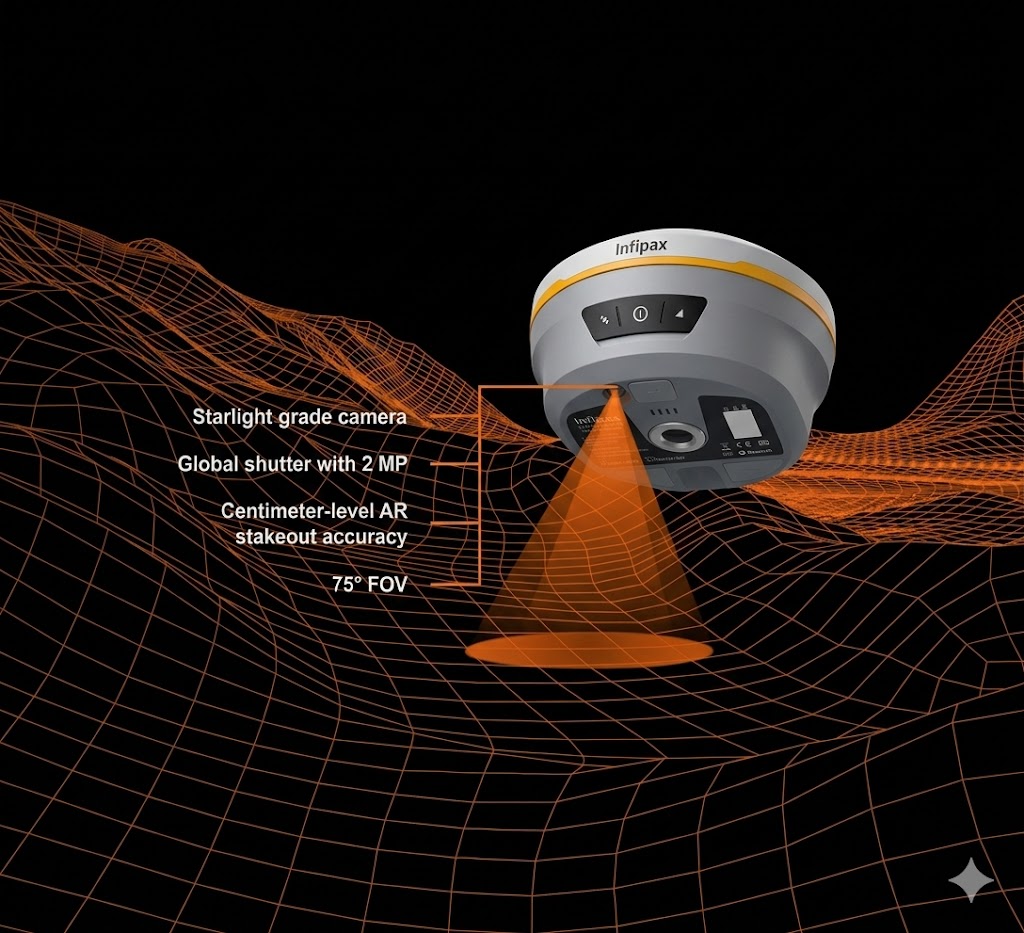


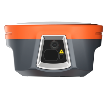
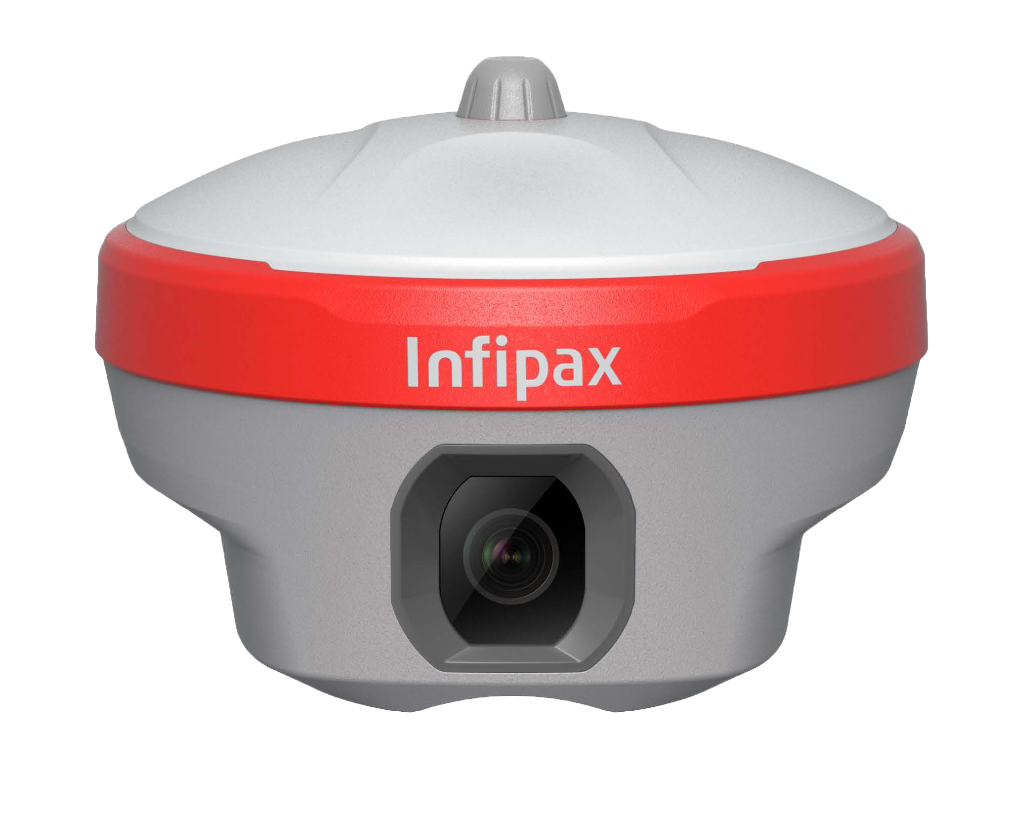
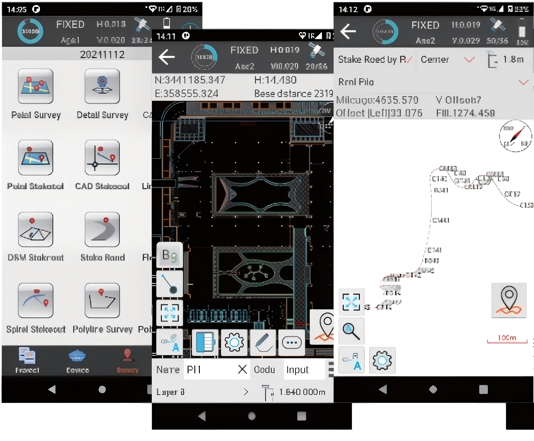
AR Stakeout with camera
2MP starlight-grade camera offers intuitive visual stakeout, supporting centimeter-level AR guidance with a 75° field of view for accurate results, even in low-light conditions.
Full Constellations Tracking
With an integrated 1408-channel GNSS
module, L20 can receive signals from BDS,
GPS, Galileo, Glonass, and QZSS. Especially in
complex environments, where more signal
reception means more data redundancy and
richer available scenarios.
60° Tilt, 5s Initialization
With the new generation of IMU module, you can easily initialize the IMU in just 5 seconds and start tilt measurements up to 60°. One initialization can meet the accuracy requirement of ±2.5cm for the whole work.
AR Stakeout
Full Constellations
60° Tilt Surveying


