
.png)

RTK
L20
The L20 achieves industry-leading accuracy across modes: Static (±2.5mm + 0.5 ppm RMS), RTK (±1.0cm + 1 ppm RMS horizontal / ±1.5cm + 1 ppm RMS vertical), Code Differential (±0.4 m RMS), SBAS (±0.5m), and PPP (±1.0cm + 0.20min RMS). This precision meets the strict requirements of professional surveying and mapping scenarios.
L20 integrates rich connectivity: Cellular (TDD-LTE/FDD-LTE/EDGE/GPRS/GSM), Wi-Fi (802.11b/g/n), Bluetooth (V5.0 BLE), serial port (115200/9600/4800/2400 baud rate), and radio module (410-470MHz). It also has 1 USB-Type-C port (battery charge/data transfer), 1 SMA connector (internal radio antenna), 1 N-type SMA port (external radio), ensuring flexible connection with field devices.
The L20's tilt survey function allows accurate positioning without strict horizontal leveling of the receiver (supports ±60° tilt angle), eliminating the need for repeated adjustment of the survey pole. This reduces operation time by 25% and is especially useful in narrow spaces or uneven terrain where leveling is difficult.
The L20's magnesium-aluminum alloy housing (dimension φ40mm × 87mm, weight only 78g) balances lightweight portability and rugged durability. It resists impact, vibration, and corrosion, ensuring long-term use in outdoor surveying scenarios while reducing the burden of field workers.
The technical datasheet (L20-Datasheet-V2.4-ENG.pdf) is available for free download on the official product page (https://162.62.120.47/product/L2). For further inquiries about product specifications or technical details, you can contact the team via the "Contact Us Now" button on the product page to get professional support.
L30
Yes. The L30 fully supports BDS (Beidou) B05/B1I/B2I/B3I/B1C/B2a signals, as well as GPS, GLONASS, Galileo, and QZSS. It has 1408 tracking channels, ensuring stable signal reception in urban canyons, rural areas, and other complex environments in China.
The L30 product includes a 2-year warranty, 7×24-hour technical support (+86 021-80147912), and free firmware upgrades for life (including Beidou algorithm optimization). On-site debugging services are available in Beijing, Shanghai, Guangzhou, and Shenzhen, with a spare parts warehouse in Shanghai for fast replacement.
L30 adopts multi-frequency anti-jamming technology: 1) Built-in SAW filter to resist radio frequency interference; 2) Beidou/GPS multi-system fusion positioning to avoid single-system signal loss; 3) IMU inertial navigation auxiliary positioning (can maintain centimeter-level accuracy for 30 seconds without satellite signals), suitable for tunnel, forest and other occluded environments.
On-site calibration steps: 1) Place the base station at a known coordinate point and complete station setup; 2) Turn on the rover station and connect to the base station via radio/4G; 3) Collect at least 3 known control points for parameter solving; 4) Verify the calibration result with a check point (error ≤2cm is qualified). Our technical team can provide remote guidance or on-site calibration services.
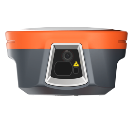
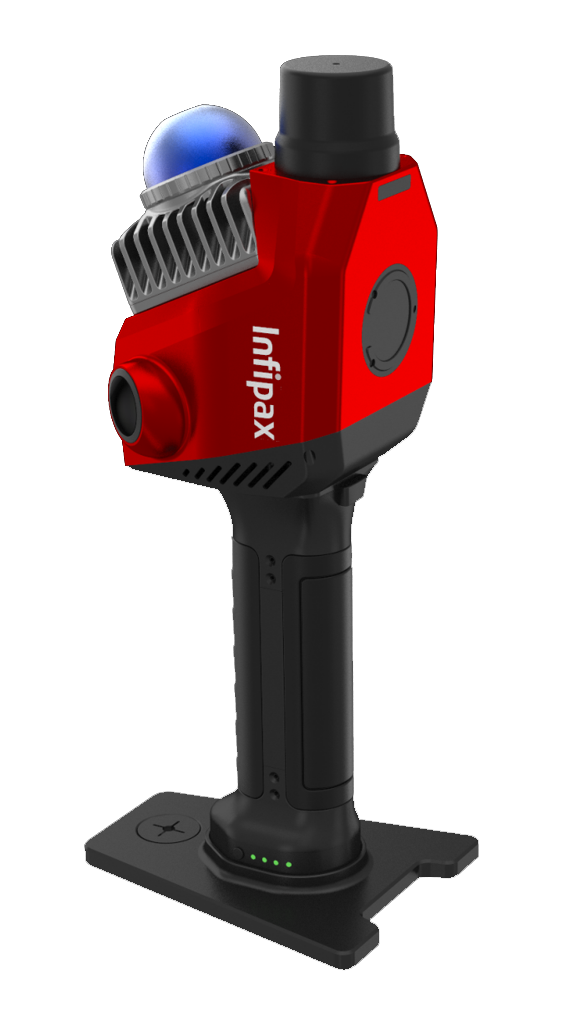
M8
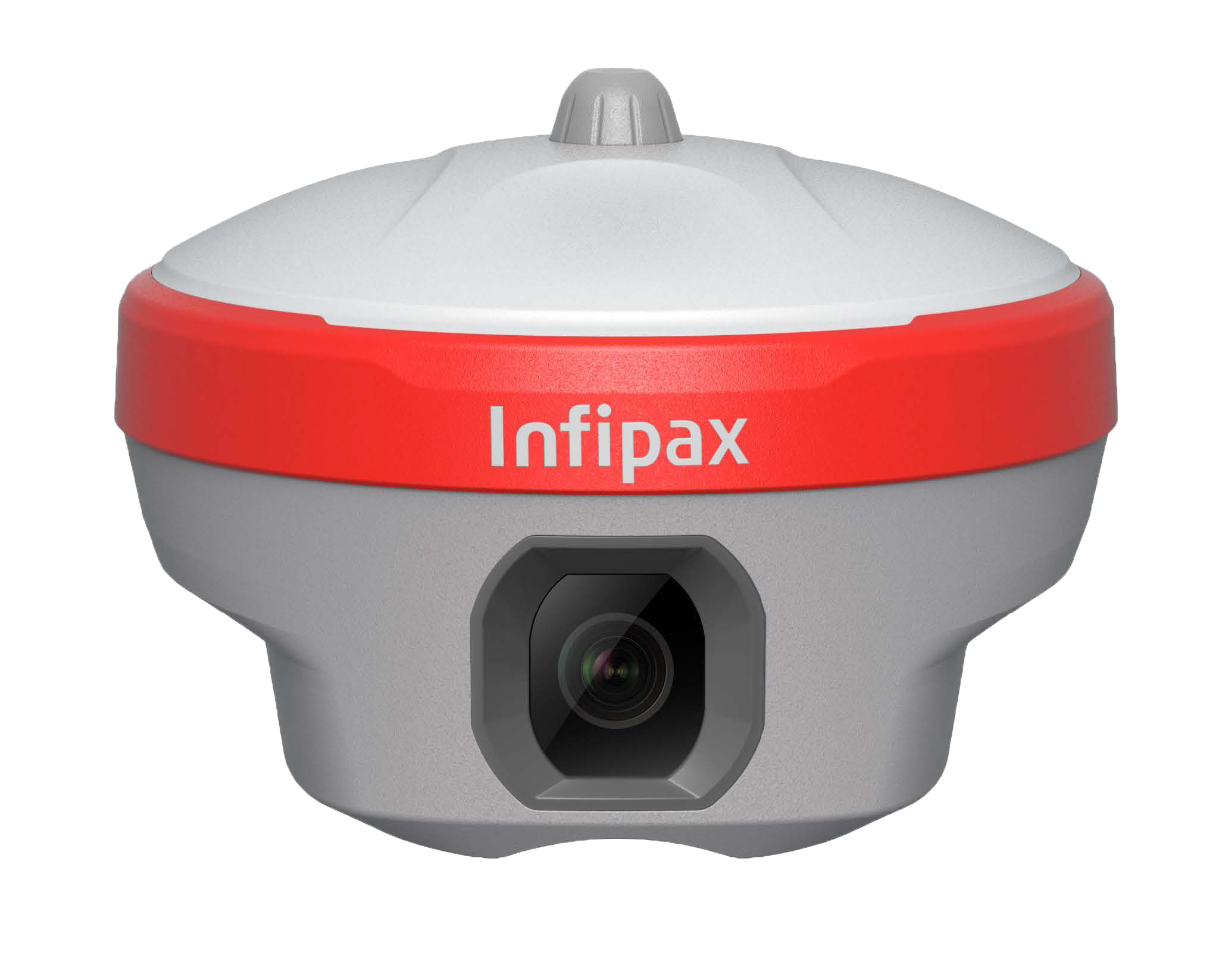
The M8 features high-precision laser measurement with multiple ranges: ±1.0 mm (≤10m), ±2.5 mm (≤30m), ±0.5 cm (≤50m). It supports tilt compensation (±60° tilt angle) and anti-magnetic interference, ensuring accurate laser ranging even in complex field environments without strict horizontal calibration.
M8 is equipped with dual cameras (front + bottom) for visual surveying: Front camera (field of view 107°, resolution 1920×1080, focal length 2.0m) and bottom camera (field of view 81.4°, resolution 1920×1080, focal length 2.0m). Both cameras support AR stakeout and visual positioning, enhancing field operation efficiency.
M8 is powered by a built-in 3.6V/13000mAh lithium battery, providing 20 hours of operation in static mode and 10 hours in rover mode. It has IP68 protection (waterproof/dustproof), anti-drop (1.8m fall resistance from pole to concrete), and works in -30℃~65℃ temperature range, adapting to harsh outdoor conditions.
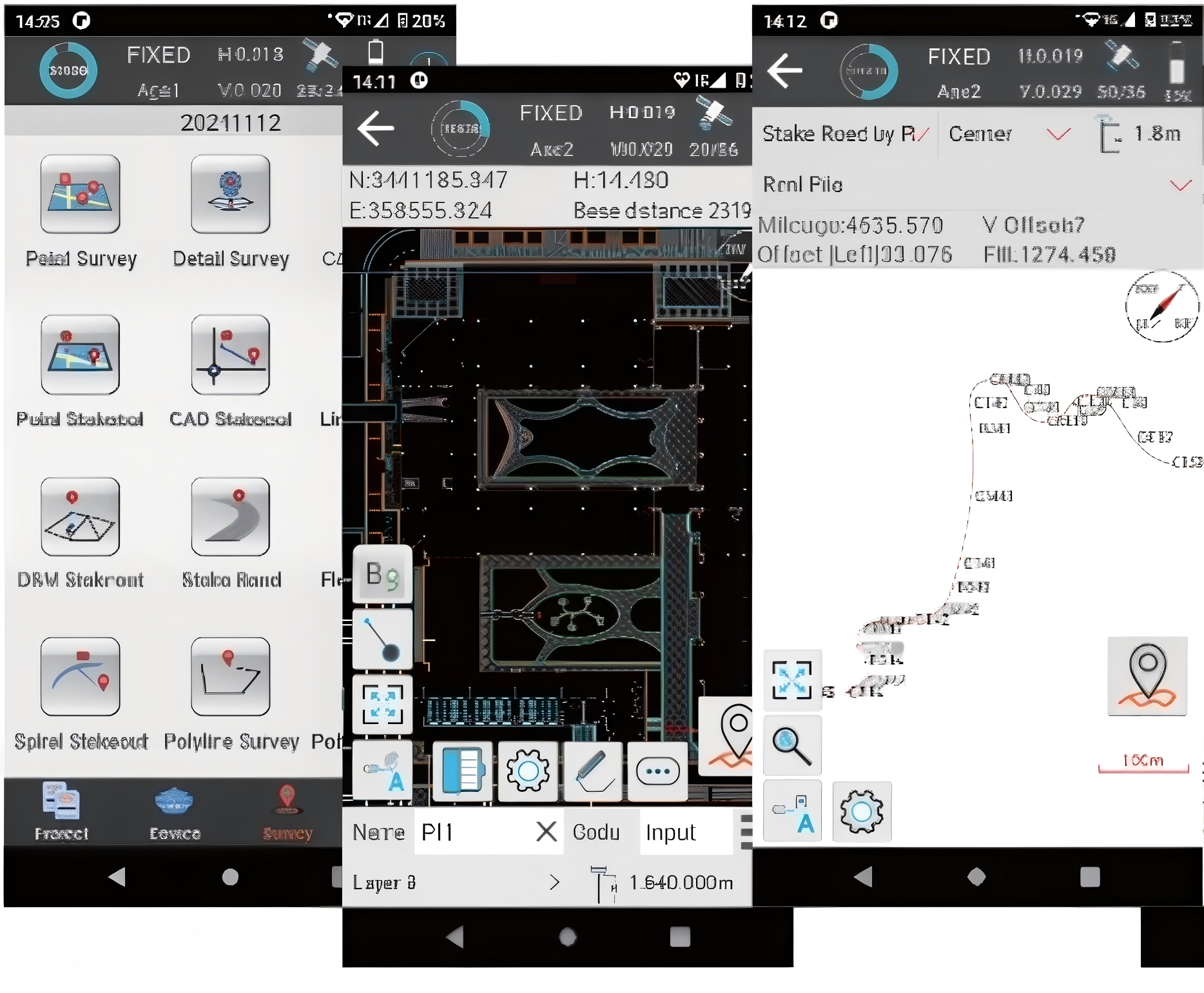
M8 supports binary data format, NMEA-0183 positioning format, RTCM2.X/RTCM3.X correction protocol, and RTCM client/server mode. It can seamlessly integrate with domestic surveying and mapping software (compatible with CGCS2000 coordinate system) and export data in SHAPE/SHP format for further analysis.
M8 is equipped with advanced anti-magnetic interference technology and quick initialization (≤5s) after power-on. It can maintain laser measurement accuracy even in environments with strong magnetic fields (e.g., near power lines, metal structures), with a reliability rate of over 99.9% in actual field tests.